PĀ
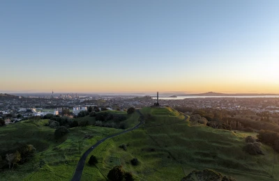
Maungarei means 'watchful mountain' and is a reference to this Maunga as a highly strategic vantage point, and the ability of the inhabitants to resist attack.
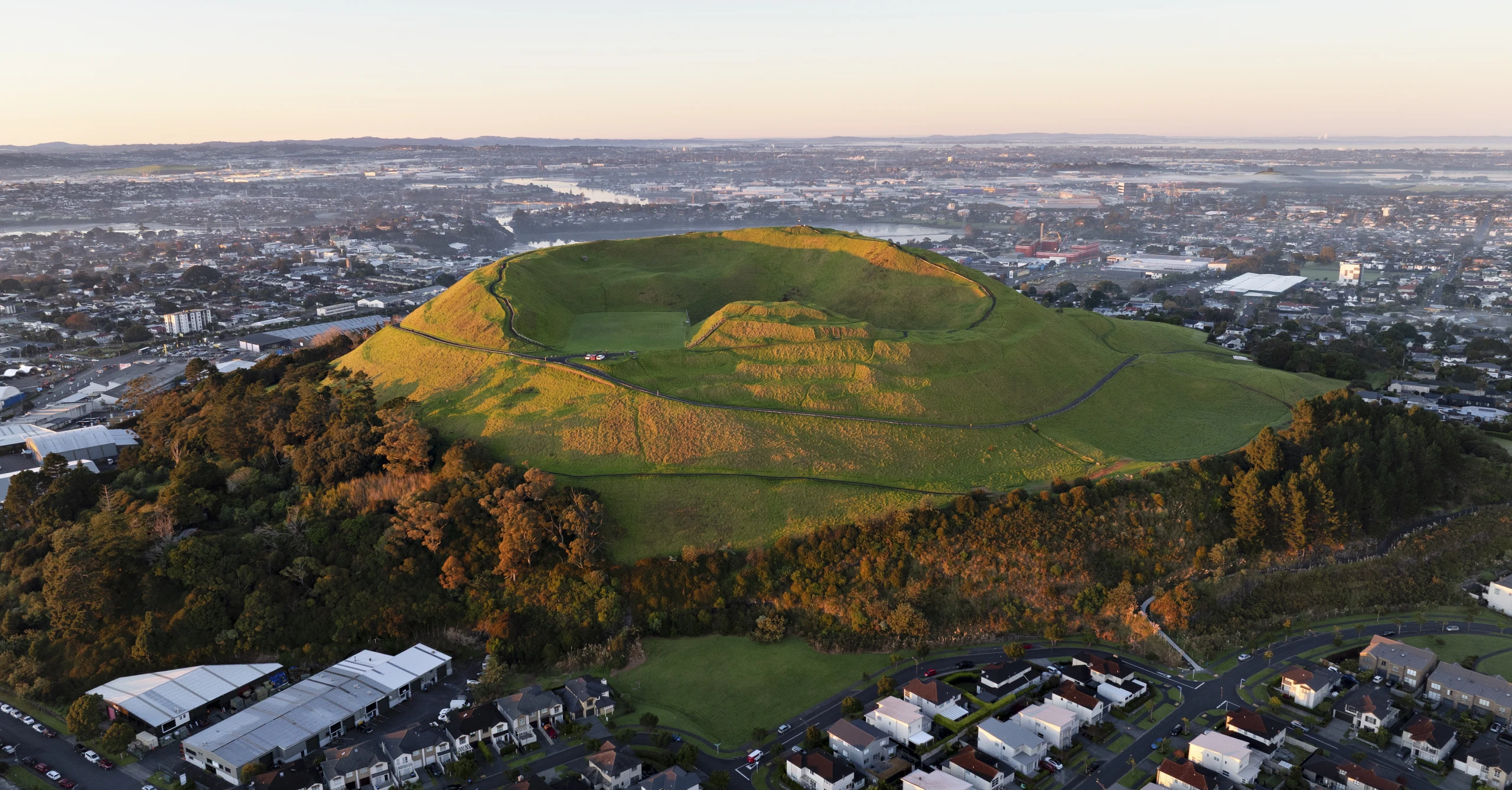
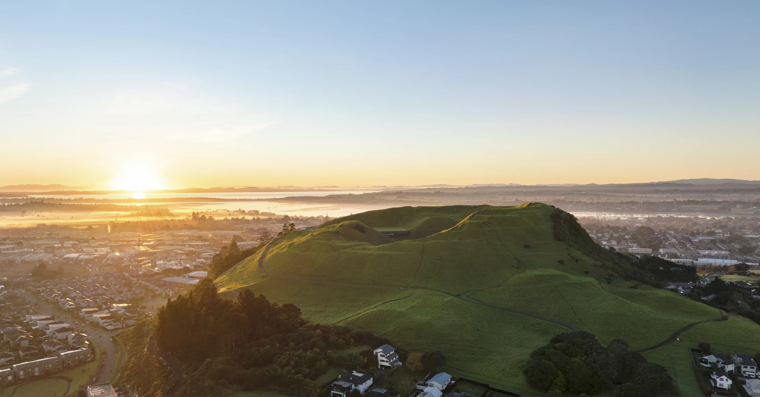
Maungarei is one of the best preserved maunga pā (village settlement) in Tāmaki Makaurau / Auckland and occupation by Māori dates to around 1400AD. The main construction of pā terraces and pits that we see today have been dated back to the mid-sixteenth and late-seventeenth centuries.
Being adjacent to the Tāmaki River and the modern-day Panmure Basin, and surrounded by expansive and fertile volcanic soils, Maungarei was ideally positioned for crop cultivation and access to marine resources. The form of the Maunga with steep slopes and a high summit allowed for the settlement to be skillfully defended.
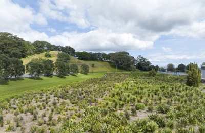
Around the slopes of Maungarei, sophisticated layers of terracing were created and positioned here were tāpapa (garden mounds) with retaining walls made of volcanic scoria rock, rua (roofed storage pits) for seasonal storage of kūmara and other crops, and hāngi (earth oven) pits. Pits were also positioned around the crater rim, which survives to this day. Also around the rim were strongpoints defended by ditches. Around the base of Maungarei were gardens for agriculture, divided by rock walls.
Shellfish harvested from the Manukau and Waitematā Harbours were a rich source of food for the inhabitants of Maungarei and the midden (shell deposits) in the crater-rim walking tracks and dirt banks of the Maunga today are the remnants of these feasts.
These important archaeological features are highly sensitive to erosion and visitors must take care when walking around the Maunga.
GEOLOGY
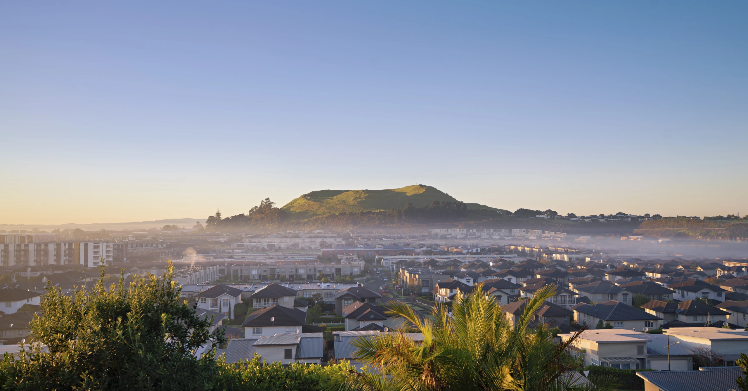
Maungarei / Mt Wellington is Auckland's second-youngest volcano, having erupted around 10,000 years ago. It is also one of the tallest, at 100 meters from its base to the tihi (summit).
Two large craters were formed in the eruption. One still exists, while the other was filled with a concrete water reservoir in 1960.
Lava pouring from vents at the base of Maunga filled the valley below. The main lava stream flowed southwest in a wide path through modern-day Ellerslie and towards Penrose, where it was blocked by lava rock from the earlier flows from Maungakiekie / One Tree Hill and Rarotonga / Mt Smart.
This lava flow dammed several side valleys and formed small swamps. These were trained in European times and are now known as Michaels Ave Reserve, College Rifles Park. What is now Waiatarua Reserve in Meadowbank was a freshwater lake and wetland, also now drained.
VEHICLE-FREE SUMMIT
To recognise the cultural, historic and archaeological significance of the Maunga, the summit road and the tihi (summit) at Maungarei / Mt Wellington was permanently closed to private motor vehicles, including motorbikes and scooters, in December 2018.
If you have limited mobility and cannot walk to the tihi, you can request to drive to the tihi in your own vehicle. Call us on 09 379 1340 to request an access code for the gate at the start of the summit road.
A visitor car park and a toilet block are located beside the main entrance to the Maunga on Mountain Road. Parking time limits are enforced to give all visitors equal parking opportunity.
MAIN ENTRANCE GATE OPENING HOURS
Summer: 7 am – 8.30 pm
Winter: 7 am – 7 pm.
Times align to Daylight Savings.
DOG RULES
Under control ON leash.
Please make sure to pick up after your dogs and dispose of waste in rubbish bins.
LOCATION
36 Mountain Road, Mount Wellington, Auckland